- Inca Trail Availability
- Travel Guide
- About us
- Payments
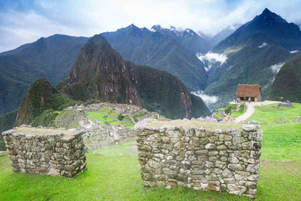
- Machu Picchu
Machu Picchu stands as a powerful testament to human ingenuity and ancient civilization. This incredible stone city, hidden high in the Andes Mountains of Peru, reveals a deep connection between nature and architecture. Built by the Inca people centuries ago without modern tools, its precision and harmony with the surrounding landscape are truly astonishing. Every wall and terrace speaks of advanced knowledge and meticulous planning. Visiting Machu Picchu offers a unique glimpse into a vanished world, inviting reflection on the builders’ lives and beliefs. It reminds us of humanity’s capacity for grand creations and the enduring legacy of a remarkable culture that understood how to live powerfully within its environment.

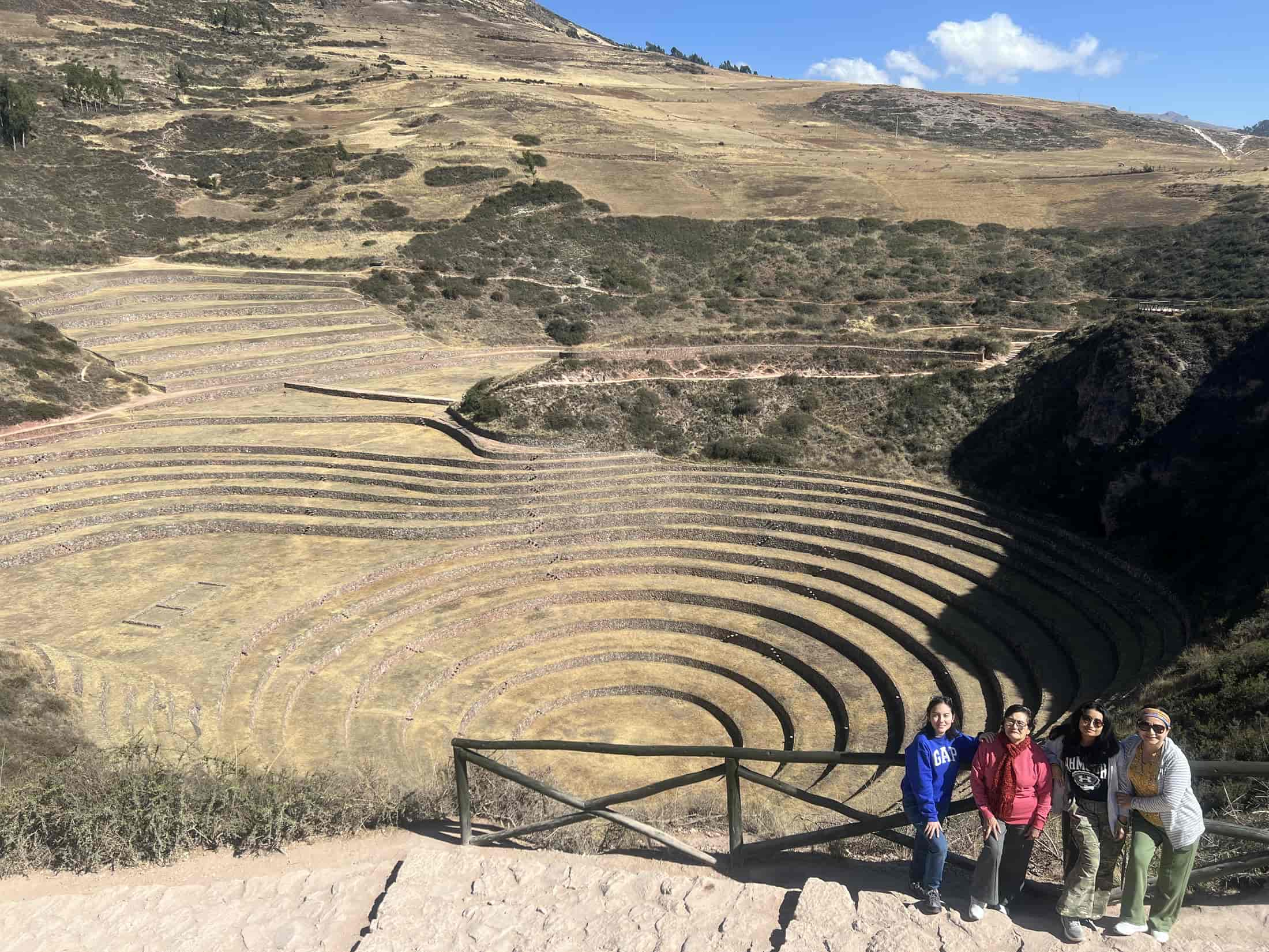
- Sacred Valley
The Sacred Valley of the Incas, nestled between the towns of Pisac and Machu Picchu in the Peruvian Andes, offers a profound journey into a vibrant past. These tours reveal a landscape where ancient traditions still thrive amidst stunning natural beauty. Visitors explore remarkable Inca ruins, like the agricultural terraces of Pisac and the formidable fortress of Ollantaytambo, witnessing the incredible engineering skills of a bygone era. Beyond the stones, the valley is home to thriving local communities, preserving age-old customs and crafts. Engaging with the people and experiencing the vibrant markets provides a tangible link to a continuous cultural heritage. A Sacred Valley tour is more than sightseeing; it’s an immersion into a living history, showing how a powerful civilization shaped its environment and left an enduring mark.

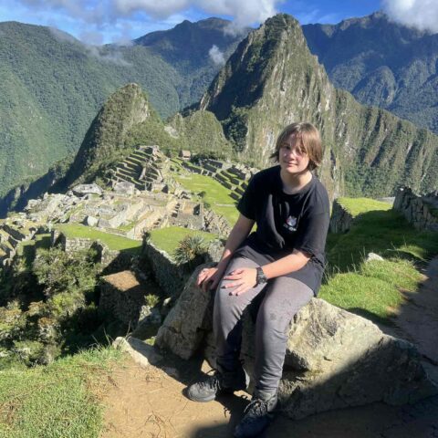
- Inca Trails
The Inca Trail is an ancient pilgrimage route located in the Peruvian Andes, leading to the remarkable site of Machu Picchu. This historic pathway, part of a vast Inca road system, traverses challenging mountainous terrain and lush cloud forests. Along the journey, hikers discover impressive archaeological ruins, revealing the Inca’s architectural and engineering mastery. The trek culminates with an awe-inspiring entry into Machu Picchu through the Sun Gate, offering a unique perspective of this iconic citadel nestled amidst dramatic peaks. It’s a profound experience, connecting modern travelers with a rich, ancient civilization.

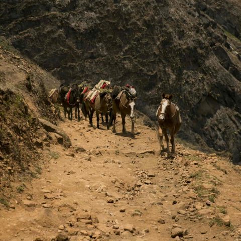
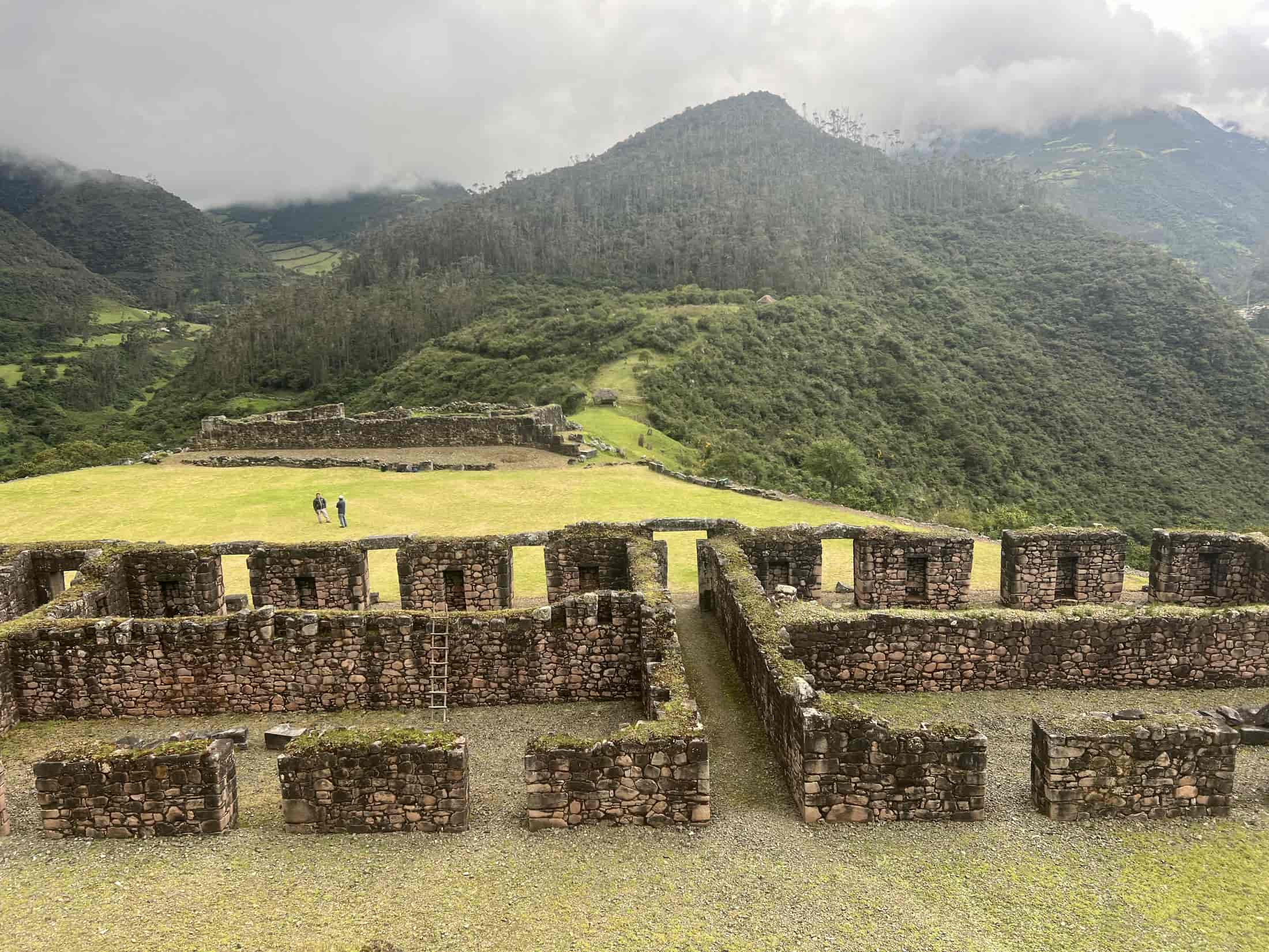
- Choquequirao
Choquequirao trek offers a profound adventure into the heart of the Andes, revealing an ancient city that echoes the grandeur of Machu Picchu but remains less explored. This challenging journey takes you through dramatic mountain passes and deep canyons to reach Choquequirao, often called the “last Inca stronghold.” Here, vast terraces, temples, and residential areas cling to steep hillsides, showcasing the incredible skill of the Inca builders. Unlike its famous counterpart, Choquequirao provides a serene and personal encounter with history, where fewer visitors allow for deeper contemplation of its silent stones. These treks are not just about reaching a destination; they are about connecting with a powerful past and experiencing the raw beauty of Peru’s untouched landscapes, a true expedition into a hidden world.
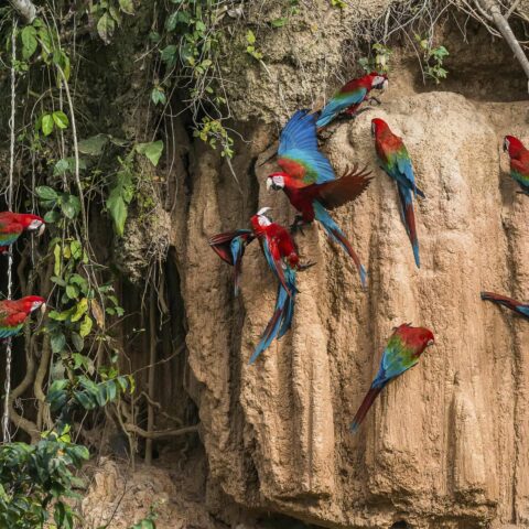
- Amazon Tours
An Amazon jungle tour offers an unforgettable dive into one of the planet’s most vital and diverse ecosystems. These expeditions take you deep into a world teeming with life, from towering trees forming a thick canopy to countless species of animals found nowhere else. You’ll navigate winding rivers, listen to the symphony of the rainforest, and witness wildlife in its natural home, often up close. Guides share their knowledge of the jungle’s secrets, revealing medicinal plants and hidden creatures. More than just a trip, an Amazon tour is a powerful reminder of nature’s raw beauty and immense power. It connects you directly with the pulse of the Earth, highlighting the importance of protecting such precious, wild places for future generations to experience.
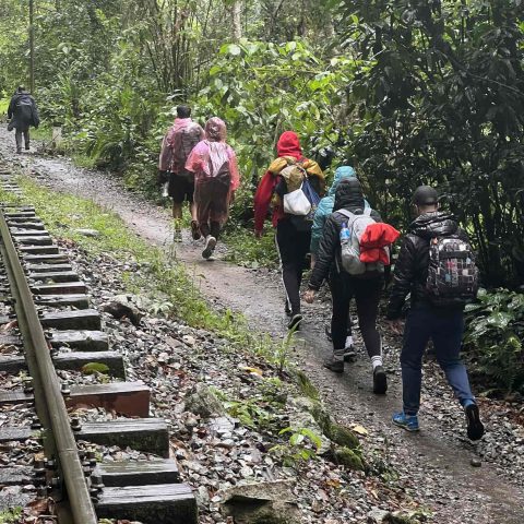
- Inca Jungle
Inca Jungle Treks offer a thrilling and diverse path to the ancient city of Machu Picchu, combining outdoor adventure with a deep dive into Peruvian culture and history. Unlike traditional treks, these journeys blend activities like mountain biking, whitewater rafting, and zip-lining with classic hiking through stunning landscapes. You’ll pass through cloud forests, coffee plantations, and small local villages, gaining a unique perspective on the region’s rich tapestry. This route provides a dynamic way to experience the Andes, moving beyond just walking to engage all your senses. It’s an active and engaging alternative for travelers seeking a more adventurous approach to reaching one of the world’s most iconic sites, culminating in the awe-inspiring views of Machu Picchu.
- Vilcabamba
Vilcabamba treks offer an extraordinary journey into a remote and historically rich region of the Peruvian Andes. This area, known as the “Last Refuge of the Incas,” holds the secrets of a civilization that resisted Spanish rule for decades. These challenging expeditions lead adventurers through untouched cloud forests, over high mountain passes, and past pristine rivers to reach ancient Inca sites rarely seen by outsiders. Unlike more frequented paths, a Vilcabamba trek provides a unique sense of discovery, allowing you to connect deeply with history in a truly wild setting. It’s a powerful experience, revealing not only stunning natural beauty but also the resilience of a remarkable culture that sought freedom in the wilderness.
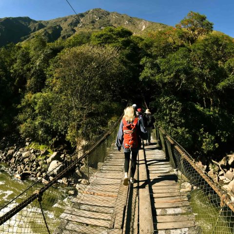
- Salkantay
Salkantay treks offer an incredible alternative route to Machu Picchu, guiding adventurers through some of the most spectacular and varied landscapes in the Peruvian Andes. This challenging but rewarding journey takes you from the foot of towering, snow-capped mountains, like the sacred Mount Salkantay, down into lush cloud forests and tropical valleys. Along the way, you’ll witness dramatic changes in scenery, from high-altitude passes to vibrant coffee plantations. Unlike the more crowded paths, the Salkantay trek provides a deeper connection with nature’s raw power and beauty. It’s an immersive experience that culminates in the breathtaking sight of Machu Picchu, earned through an unforgettable passage across truly wild terrain. This trek truly captures the spirit of adventure and discovery.
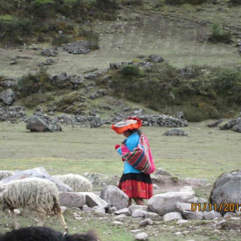
- Lares
Lares Treks in Peru offer a unique and profound way to experience the rich cultural tapestry of the Andes, providing a vibrant contrast to other, more strenuous routes. This journey takes you deep into remote valleys where traditional Inca ways of life still flourish. You’ll pass through small, welcoming communities, observe ancient weaving techniques, and witness daily life unchanged for centuries. Unlike high-altitude challenges, the Lares trek focuses on genuine human connection and cultural immersion. It’s a chance to meet local people, learn about their customs, and appreciate their strong bond with the land. This trek is more than just walking; it’s an intimate encounter with a living history, offering insights into the enduring spirit of the Andean people.